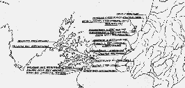
Kāpiti map

MapColl CHA-2/1/3
North Island: pre-1840 settlement. Historical Branch, Department of Internal Affairs. (Manuscript, drawn for the proposed Centennial Historical Atlas, 194-?).
Nā te Kohikohinga a Internal Affairs tēnei mahere whenua. Kei te Whare Pukapuka a Alexander Turnbull Library tēnei kohikohinga.
He mahere whenua tēnei e whakaatu ana i ngā wāhi hokohoko o roto i te rohe o Kāpiti i tērā rau tau. Ka kite koe i te motu o Kāpiti me ngā motu iti i waho o Kapiti (Tahoramaurea, Motungarara me Tokamapuna), tae atu ki Waikanae me te tuawhenua. Na, ko te rohe o Kāpiti tēnei. Na, ko ngā wāhi i hainatia ai te Tiriti o Waitangi i te tau 1840 ko Waikanae, te motu o Kapiti, Motungarara, me Mana.
